Skip to content
WILD KARAKORAM
Karakoram Grand Traverse
← All expeditions
TrekBaltistan and Hunza

Karakoram Grand Traverse

Gondogoro La, K2 base camp, the Baltoro, then the Biafo glacier, Snow Lake and Hispar La, ending among the orchards of Hunza.

35 days from Islamabad, 22 of them on foot, reaching 5,585 m. July to August, in groups of 2 to 10. Graded severe.

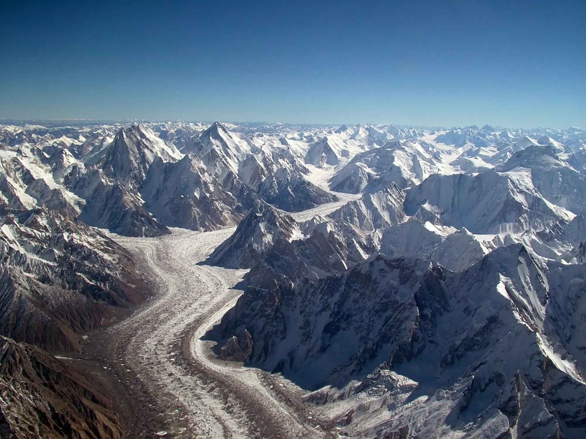
The Grand Traverse links three of the great glacier walks of the Karakoram into one long journey. You cross the Gondogoro La to K2 base camp, walk out down the Baltoro, then turn up the Biafo glacier, cross Snow Lake and the Hispar La, and walk down the Hispar glacier to Hunza. The route passes some of the highest and most beautiful mountain terrain in Asia and ends in the green orchards of Nagar. It is a long, deep expedition on foot, and one of the finest walks anywhere.

Day by day

  1. 1

    Arrive in Islamabad

    Your guide meets you at the airport, holding the company sign, and takes you to the hotel. The rest of the day is yours to recover from the flight and sort kit. The capital sits at the foot of the Margalla Hills and is a gentle place to start.

    Night at Hotel, 540 m.

  2. 2

    Fly to Skardu

    The morning flight to Skardu is one of the great mountain flights, with Nanga Parbat standing clear of the cloud on a good day. You land at the head of the Indus valley in the heart of Baltistan. The afternoon is free to walk the bazaar and settle in.

    Night at Hotel, 2,228 m.

  3. 3

    Skardu, permits and kit check

    A free day in Skardu. Walk up to Kharpocho fort for the view over the Indus and the town, or take a short trip to Sadpara lake. Your team handles the last permits and checks the porter loads while you browse the bazaar for anything you still need.

    Night at Hotel, 2,228 m.

  4. 4

    Jeep to Hushe

    A six hour jeep ride from Skardu crosses the Shyok river and winds up the Hushe valley through a string of small villages. Meltwater streams cross the road, and Masherbrum stands in view at the head of the valley.

    Night at Hushe, 3,050 m.

  5. 5

    Hushe to Saicho

    The trail climbs above Hushe through fields of barley and turnips, wild roses and the odd juniper, with tall rock peaks on either side. The valley opens out and splits near Saicho, which is a green camp beside the river.

    5 hours on foot. Night at Saicho, 3,348 m.

  6. 6

    Saicho to Dalsampa

    A short stage along the eastern side of the Gondogoro glacier, with Masherbrum growing larger ahead. You scramble along the glacier edge for an hour or so, and the camp at Dalsampa has fine views of the ice.

    4 hours on foot. Night at Dalsampa, 4,150 m.

  7. 7

    Dalsampa to Khuispang

    You step onto the middle of the glacier and walk on a mix of moraine and clean ice, with the Gondogoro La coming into view ahead. Khuispang sits at the heart of the Karakoram, below Laila Peak.

    6 hours on foot. Night at Khuispang, 4,590 m.

  8. 8

    Rest day at Khuispang

    A day to rest and let the body adjust to the altitude. Laila Peak is a beauty from camp, and Trinity Peak stands across the glacier. A short walk up the moraine gives views down the valley.

    Night at Khuispang, 4,590 m.

  9. 9

    Gondogoro La to Ali Camp

    The team climbs to the 5,585 m pass on fixed ropes. From the top you see four of the Baltoro's eight thousand metre giants together: K2, Gasherbrum I, Broad Peak and Gasherbrum II. The easier descent on the far side leads to Ali Camp.

    10 hours on foot. Night at Ali Camp, 4,800 m.

  10. 10

    Spare day at Ali Camp

    A day held in reserve for the weather at the pass. If you are on time it is a day to rest, enjoy the mountain views and recover from the crossing.

    Night at Ali Camp, 4,800 m.

  11. 11

    Ali Camp to Concordia

    You arrive at the junction of the Baltoro, Godwin-Austen and Broad Peak glaciers. Four of the world's eight thousand metre peaks are in view, along with dozens of summits above 6,500 m. It is hard to look anywhere without finding another great mountain.

    6 hours on foot. Night at Concordia, 4,500 m.

  12. 12

    K2 base camp, Broad Peak and the Gilkey memorial

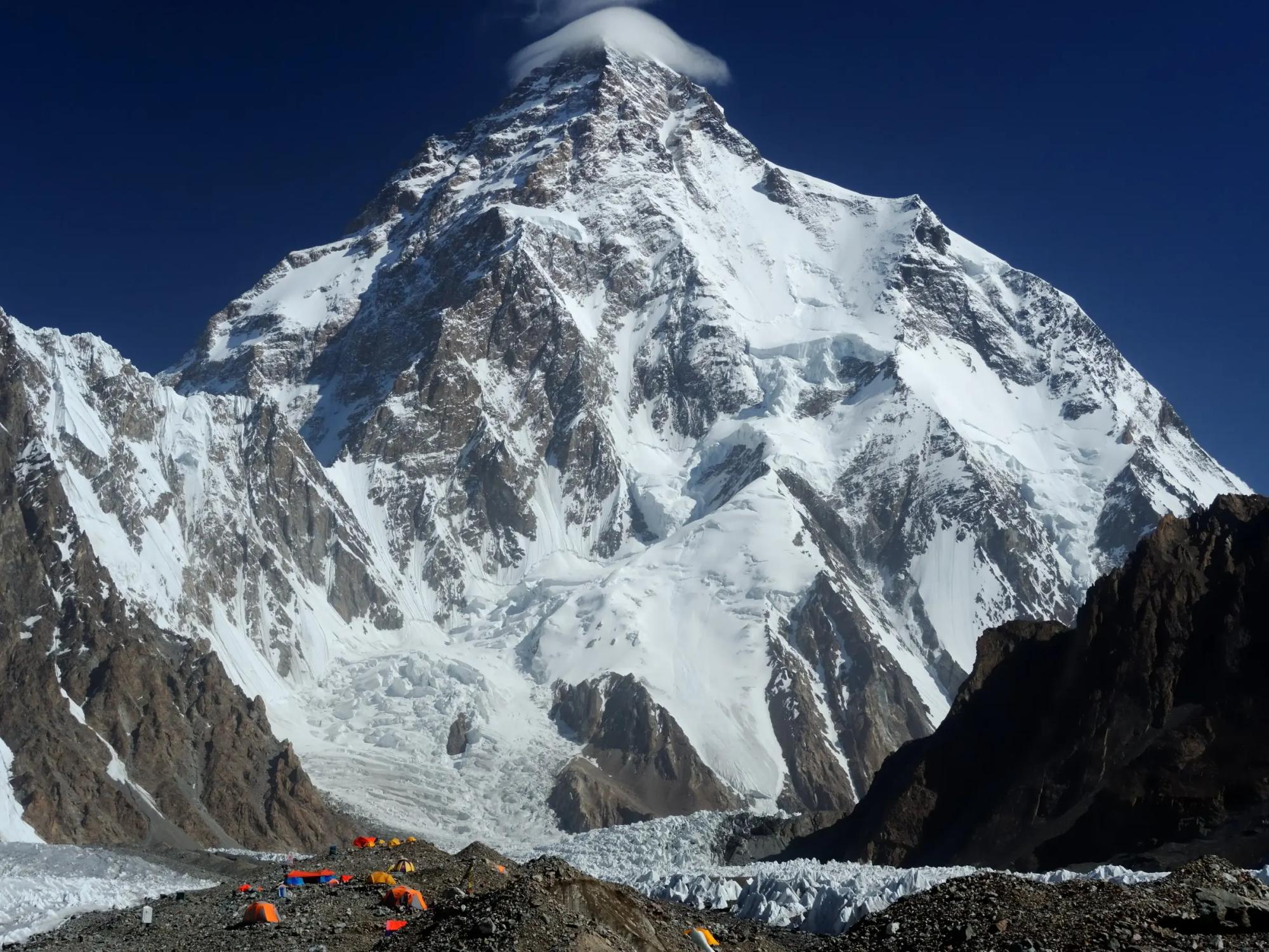
    Up the Godwin-Austen glacier you walk past Broad Peak base camp and the memorial to Art Gilkey to K2 base camp, with the pyramid of K2 filling the sky. It is a spectacular and emotional day, and the high point of the traverse.

    8 hours on foot. Night at K2 base camp, 5,125 m.

  13. 13

    Back to Concordia

    A retrace down the glacier to Concordia for a night's rest. K2 behind you and the long walk ahead make for a good evening in camp.

    6 hours on foot. Night at Concordia, 4,500 m.

  14. 14

    Concordia to Goro I

    An easy descending stage along the glacier, back down past the junction at Goro II to the camp at Goro I.

    5 hours on foot. Night at Goro I, 4,010 m.

  15. 15

    Goro I to Khoburtse

    You follow the same trail past Urdukas, but the light and angle make the views of the Trango Towers feel entirely new. Khoburtse is a good camp for the first grass in days.

    7 hours on foot. Night at Khoburtse, 3,788 m.

  16. 16

    Khoburtse to Paiju

    You walk down the side of the glacier through Liligo, the last stretch of moraine, and arrive among the trees and green grass at Paiju.

    7 hours on foot. Night at Paiju, 3,418 m.

  17. 17

    Paiju to Korofon via Jhola

    An easier day along the Braldu gorge, past Jhola, with a few river crossings. The camp at Korofon sits across from the snout of the Biafo glacier.

    7 hours on foot. Night at Korofon, 3,075 m.

  18. 18

    Rest day at Korofon

    Korofon lies at the foot of the Biafo, the third longest glacier outside the polar regions, and the doorway to the Hispar La and Snow Lake. A day to rest, wash clothes and prepare for the next leg. The porters sort loads for the glacier.

    Night at Korofon, 3,075 m.

  19. 19

    Korofon to Namla

    The trail leaves the Baltoro path and turns north-west onto the Biafo glacier. It climbs a shoulder to the left moraine, descends onto the ice and returns to the bank at Namla, a grassy camp behind a lateral moraine.

    6 hours on foot. Night at Namla, 3,571 m.

  20. 20

    Namla to Mango

    The route crosses a fractured zone to the centre of the glacier and follows the ridges of moraine. The camp at Mango is on grass on the left bank of the Biafo.

    7 hours on foot. Night at Mango, 3,715 m.

  21. 21

    Mango to Baintha

    A broad highway of ice carries you up the centre of the Biafo. You come off the glacier to the grassy camp at Baintha, with the Latok group and the Ogre in view.

    6 hours on foot. Night at Baintha, 4,041 m.

  22. 22

    Rest day at Baintha

    A rest day for you and the porters. A walk up the ridge behind camp gives fine views of the Latok peaks and the Ogre, and ibex are often on the grass slopes above.

    Night at Baintha, 4,041 m.

  23. 23

    Baintha to Marpogoro

    A steep start leads onto the glacier, which then flattens into easy walking. The Ogre (7,813 m) is magnificent, and the first views open towards the Hispar La and Snow Lake.

    6 hours on foot. Night at Marpogoro, 4,298 m.

  24. 24

    Marpogoro to Hispar La base camp

    You walk to the southern end of the great snowfield known as Snow Lake, threading through a network of crevasses. Snow Lake is a glacial basin more than 16 km wide, named by Martin Conway in 1892, who called the view the finest mountain scene he had ever seen.

    6 hours on foot. Night at Hispar La base camp, 4,585 m.

  25. 25

    Across Snow Lake to Hispar La

    High point

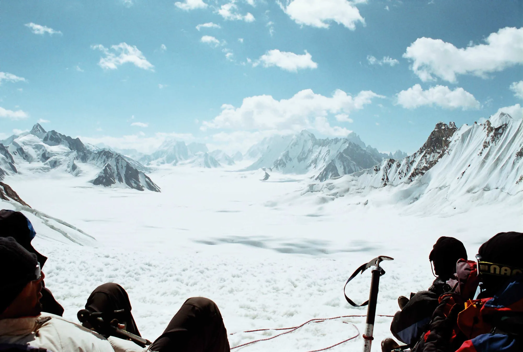
    The team crosses Snow Lake and climbs to the Hispar La at 5,149 m. The slope is not steep, but the altitude makes it a full day. From the pass you look down the Biafo to the Ogre in one direction and down the Hispar glacier to the peaks of Hunza in the other.

    9 hours on foot. Night at Hispar La, 5,149 m.

  26. 26

    Hispar La to Kani Basa

    An early start descends from the pass and crosses a crevassed zone before the glacier flattens. You cross the Kani Basa glacier, where two great ice streams meet, and camp in a grassy side valley facing Kanjut Sar (7,760 m).

    8 hours on foot. Night at Kani Basa, 4,468 m.

  27. 27

    Kani Basa to Jutmal

    A day of route finding through moraine ridges, up a scree slope and across several glacial streams. Jutmal is a grassy camp along the side of the glacier.

    7 hours on foot. Night at Jutmal, 4,168 m.

  28. 28

    Jutmal to Bitanmal

    You descend a steep bank to cross another side glacier and rejoin the valley, where the walking is good. Bitanmal is a large meadow used by the herders of Hispar village.

    6 hours on foot. Night at Bitanmal, 3,765 m.

  29. 29

    Bitanmal to Falaling Chhish

    The last side glacier crossing is over the Kunyang glacier, followed by a steep path and a stream crossing to the meadows at Falaling Chhish.

    6 hours on foot. Night at Falaling Chhish, 3,605 m.

  30. 30

    Falaling Chhish to Hispar village

    A bridge across the river leads to Hispar village. After weeks of rock and ice, the orchards and terraced fields are astonishingly green. The jeeps meet you here or a short walk further on.

    4 hours on foot. Night at Hispar village, 2,297 m.

  31. 31

    Hispar to Karimabad

    Two hours by jeep along the narrow Hispar track to Nagar, and then the Karakoram Highway north to Karimabad. You check into a hotel, wash and take an afternoon to wander the old town.

    Night at Hotel, 2,440 m.

  32. 32

    Karimabad and Hunza sightseeing

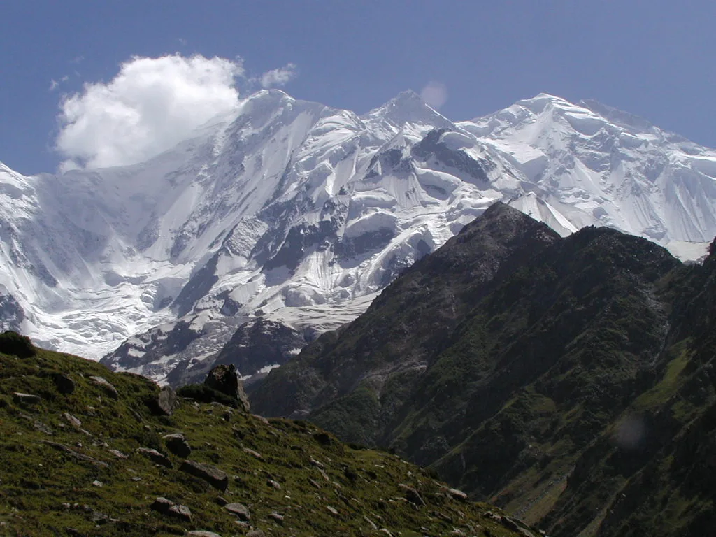
    A free day in one of the loveliest valleys in the north. Baltit fort stands over the old town, and Rakaposhi, Diran and Ultar Sar line the skyline. It is also a spare day in hand after the long walk.

    Night at Hotel, 2,440 m.

  33. 33

    Drive to Gilgit and fly to Islamabad

    The Karakoram Highway runs south to Gilgit, where you board the flight to Islamabad over the mountains. The evening is free in the capital.

    Night at Hotel, 540 m.

  34. 34

    Rest day in Islamabad

    A free day to rest, shop for souvenirs and enjoy a celebration dinner after the traverse.

    Night at Hotel, 540 m.

  35. 35

    Departure

    Your guide transfers you to Islamabad airport for your flight home.

    540 m.

Questions people ask

When is the best time to go on Karakoram Grand Traverse?
July to August is the season for Karakoram Grand Traverse, when the route is open and our departures run.
How hard is Karakoram Grand Traverse?
It is graded Severe, reaching 5,585 m with 22 days on foot. Long glacier days, camps above 4,500 m, fixed rope sections. Previous high altitude experience required.
Where does Karakoram Grand Traverse start?
Karakoram Grand Traverse starts in Islamabad and runs 35 days in total. The last day ends in Islamabad for your flight home.
What is included in the price?
The price covers domestic flights between Islamabad, Skardu and Gilgit; jeep transfers to Hushe, Askole and from Hispar; guide, cook and kitchen crew, porters and camp equipment; and full board on the trek, with tents and a mess tent. The full list of 6 items is under What we supply on this page.
How much does it cost, and when are the next dates?
Prices start at US$6,490 per person on the fixed departures. The next one runs 20 Jul to 23 Aug 2027.